Drone Mapping
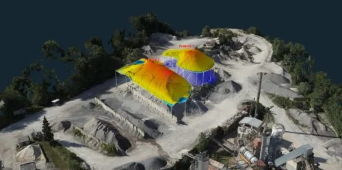
Aerial mapping using drones represents a modern way of collecting spatial data with high accuracy and efficiency. A drone equipped with professional cameras or specialized sensors captures the area from above and creates detailed images that are then processed into precise digital maps and 3D terrain models.
This technology allows you to quickly obtain data for geodesy, engineering, construction or environmental analysis. The result can be an orthophoto map, digital terrain model, 3D model of objects or data for GIS and CAD systems.
Drone mapping significantly shortens field measurement time and at the same time enables data acquisition from extensive or hard-to-reach locations.
Need aerial mapping or orthophoto? Write to us and we will prepare an individual offer.
Contact us